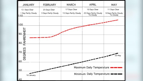
Weather Data - Chart 2
Average Range In Temperature By Month - Chart 2, January - May 1950.
Average Range In Temperature By Month - Chart 2, January - May 1950.
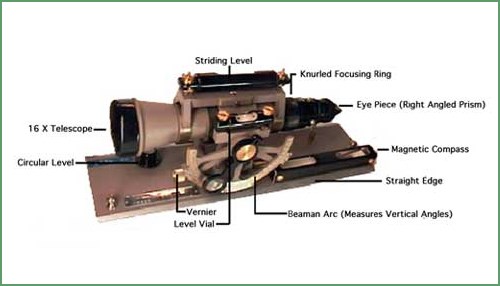
The alidade-planetable survey is a means of plotting a traverse as it is made, thus avoiding the likelihood of mathematical blunders and recording errors that arise while working with the theodolite.
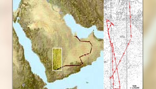
The dark brown line on the small map marks the 1998 version of Saudi Arabia's claims regarding its boundaries with Yemen, Oman, the United Arab Emirates and Qatar.
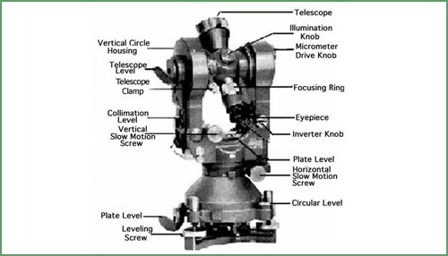
The theodolite is an instrument that measures vertical and horizontal angles precisely. With stadia lines etched on the reticule of its telescope and the appropriate stadia rod (a flat-faced rod graduated vertically, its subdivisions corresponding to one/one hundredth of the focal distance) it will measure distances with accuracy sufficient for third order triangulation.

It's been more than sixty-four years since I first went to the 'field ' in 1950 for five years (also spent another year before that in the New York Office at 505 Park Avenue).